Hiking Log #1 – Circuit Korspronk
- Last updated:
- Category:
- Hiking
I recently started hiking some local trails. It all started with the recent heatwave. To cool down a bit, I started going outside in the evening. I had my old GPS handheld lying around, so I thought I'd use it again to track my walks. As luck would have it, the rubber on the power button deteriorated after a few days of use, making the device impossible to power on or off and thus unusable. I tried to find a replacement, but none were available. This prompted me to buy a new device: the Garmin eTrex Touch.
After exploring my new town by going on some impromptu walks and getting to know my new device a little better, I thought: what better way to spend the day than doing some short local hikes? As I knew nothing about them, I asked myself where I could find some information.
Finding a trail without app lock-in
As I would like to be more digitally independent, one of my requirements is the ability to download a GPX or similar track. Secondly, I don't want to be bound to an app or service provider. I therefore wanted to avoid making a particular app or online service an essential part of finding and following a trail. Apps such as Komoot or Wikiloc are out of the question.
For geographical data in Luxembourg, my go-to place is the national geoportal of the Grand-Duchy of Luxembourg, also known as "Geoportail". Yes, it has details on all hiking trails. The only disadvantage is that I cannot filter them by length or difficulty.
This prompted me to do some more research, which led me to Wanderweeër Lëtzebuerg (WWL), an independent project run by a Luxembourgish hiking enthusiast. Here, we can filter trails by keyword, category, distance and difficulty. I looked around to find an easy, short local hike and found the "Circuit Korspronk".
Trail details
| Distance: | Time: | Overall pace: | |||
|---|---|---|---|---|---|
| Maximum elevation: | Minimum elevation: | Average elevation: | |||
| Ascent: | Descent: | ||||
| Average speed: | Maximum speed: |
The interactive trail map could not be loaded.
Why I chose "Circuit Korspronk"
The Visit Luxembourg website presents "Circuit Korspronk" as a journey to the modest beginning of a much longer river. Starting near the centre of Differdange, the circular trail climbs through fields and shaded woodlands to the source of the Kor, the local name for the Chiers, which flows on through Belgium and France. The combination of nature, local history, and its manageable length made it seem like an ideal choice for my first local hike.
Bearing this in mind, I loaded the trail and parking POI onto my GPS handheld, packed some water and fruit, and set off on a sunny Friday afternoon to complete my first local hike.
Elevation is not everything
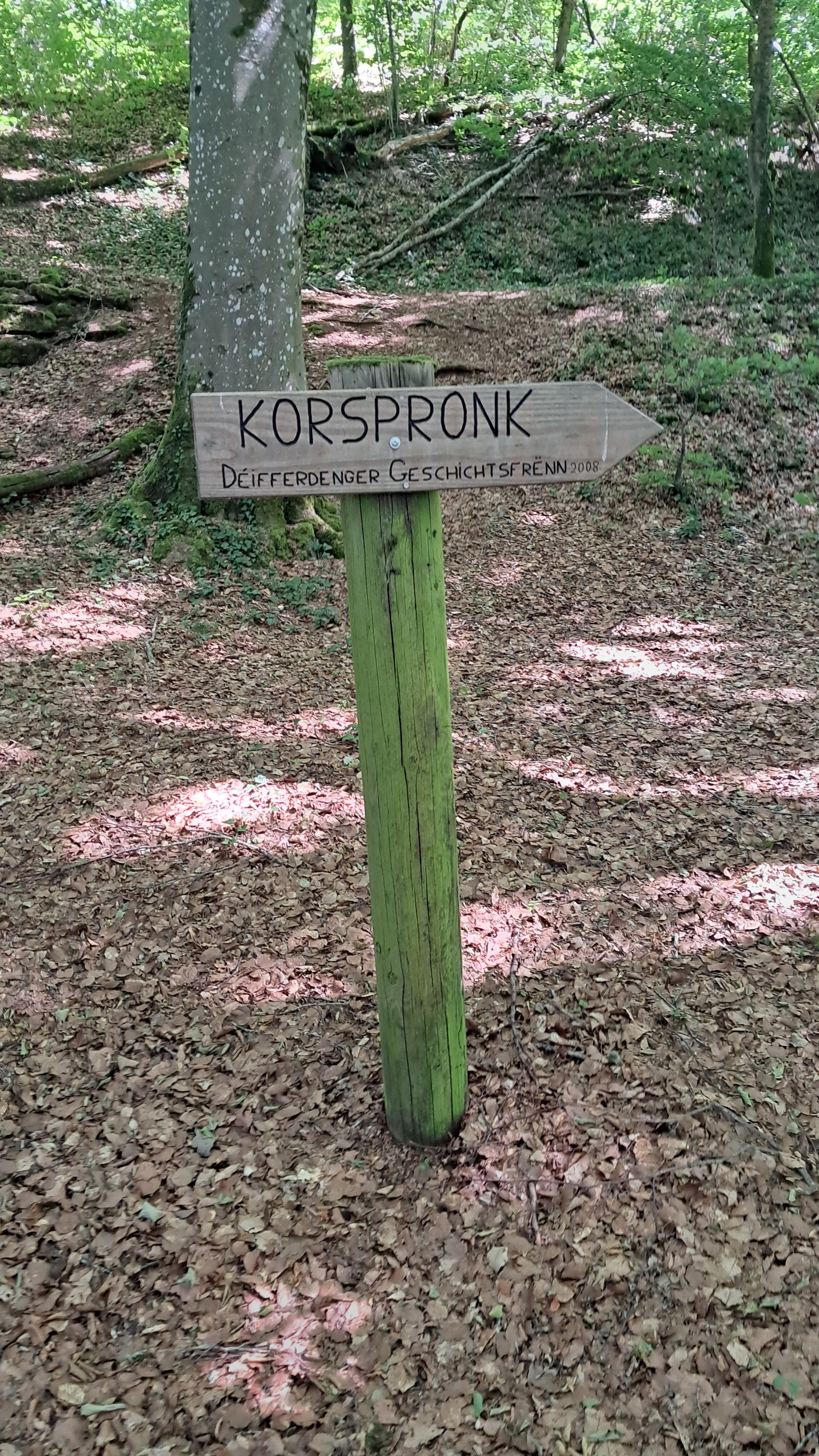
The wooden sign pointing towards the source of the "Kor" bears the name "Déifferdenger Geschichtsfrënn" (literally the "Friends of Differdange History") and the year 2008.
The trail begins near the Aalt Stadhaus, the former city hall which is now a cultural centre. It also houses the local library and music school and functions as a local theatre. Very close by is the current city hall, which is being demolished due to construction defects and structural problems and will need to be rebuilt.
From there, the trail goes up "Rue Metzkimmert", which was quite an ordeal for an untrained hiker like me — I could really feel it in my heart rate! This showed me that elevation is not everything; the slope clearly plays a role too. After this steep ascent, the trail enters the shady woods, where the air felt noticeably cooler than the air in town. The change was immediately refreshing.
I followed the trail to an open area with a picnic table, then passed the shooting range in Oberkorn before returning to the woods. Continuing, I arrived at a set of wooden stairs and the main attraction and namesake of this trail: the source of the river Chiers, or in Luxembourgish "Kor".
What the information panels taught me
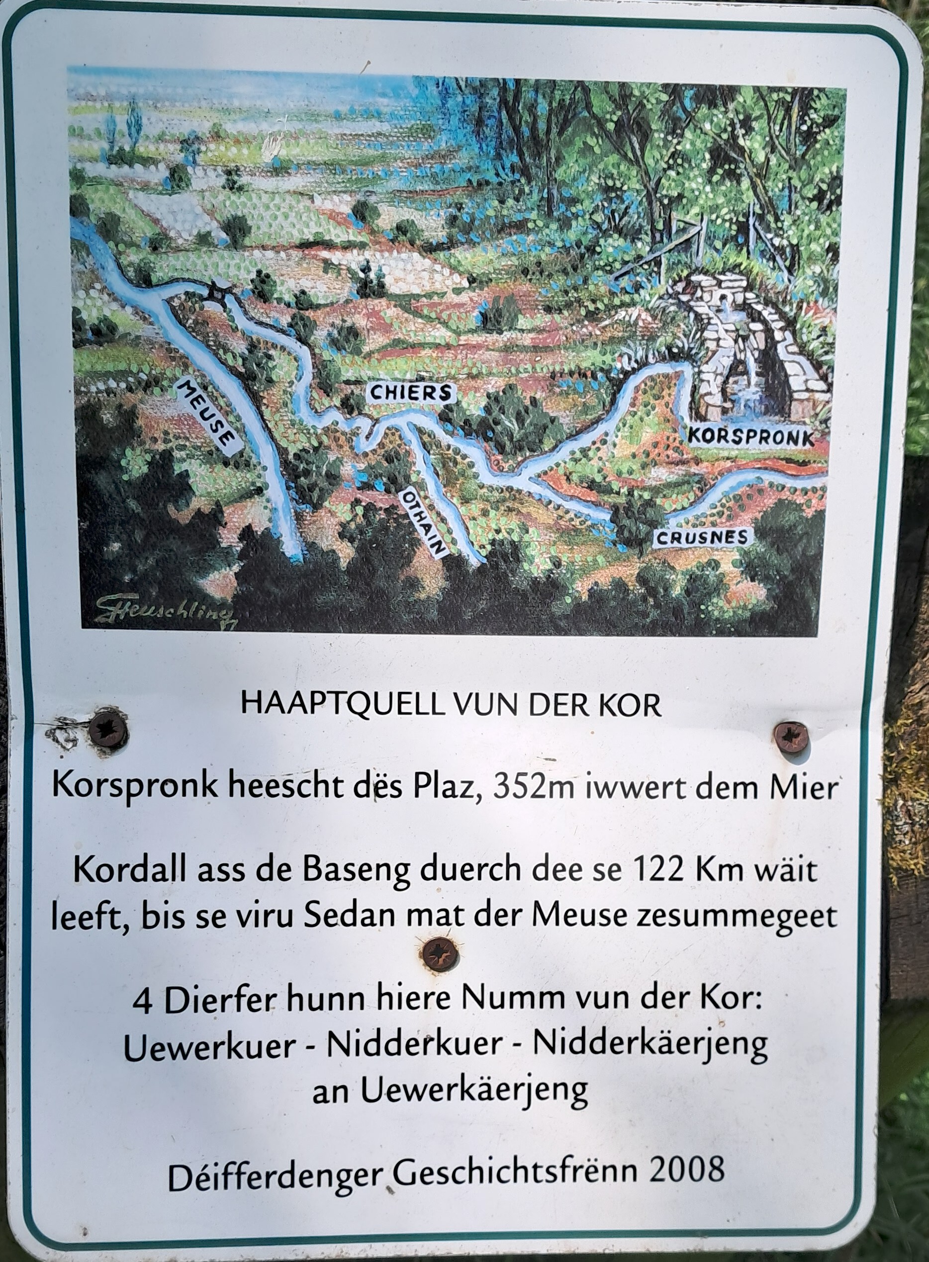
The information panel next to the spring.
A nearby metal panel provides information about the "Kor". According to the information panel, the source lies 352 metres above sea level and the river is 122 kilometres long. From Differdange, the "Kor" flows through the "Kordall" valley before continuing through Belgium and France and eventually joining the Meuse in Sedan, a commune in France.
I actually learnt something new here! There are four towns that contain the river's Luxembourgish name: "Uewerkuer", "Niederkuer", "Nidderkäerjeng", and "Uewerkäerjeng". More information about the names can be found on a later information board. The board proposes that the name "Kor" derives from "Kar", a pre-Celtic word associated with water, streams or marshland. It also connects the later French name "Chiers" with "cher" and the Latin word "carus". I have not been able to verify this proposed etymology independently, but it is an intriguing example of how local place names can preserve older layers of language.
Interestingly, the spring is located halfway along the trail. It is surrounded by concrete, so I could only see where the water flows out. There is also a bench here. It's a nice place to relax. Unfortunately, I forgot to take a good photo.
Continuing along the trail, I left the woods behind me and walked alongside some fields, crossing a bridge over the train tracks. I then entered the town of "Uewerkuer", passing under the train station and some allotment gardens, before reaching the cemetery of Differdange and arriving back at the start of the trail.
A question about hiking gear
At the moment, I carry a water bottle in my backpack. Taking the backpack off every time I want a drink is inconvenient, especially when my back is already warm and sweaty. I am therefore considering either a hydration reservoir, such as the CamelBak Crux, or an adapter that adds a drinking tube to an ordinary bottle.
This is where you come in! I'd love to hear your opinions, suggestions or ideas on this. You can simply write to me on Mastodon or email me—you will find my email address in the footer of this blog.
The beginning of a new habit
In my opinion, this trail has its ups and downs. The beginning can be quite exhausting if one is not fit, but as soon as I entered the woods, I felt as though I had left urban life far behind me. The source of the river is a very pleasant place and definitely the highlight of the trail. The final section was less memorable; in particular, the walk through the town of "Uewerkuer" and past the cemetery of Differdange was not very interesting.
This trail really ignited my wanderlust. Since then, I have done several others, which I will document in the future. I already feel that hiking helps me to switch off for a few moments by simply taking in the fresh air and paying attention to the beautiful, intricate, and sometimes mysterious natural world around me.