After my first hike ignited my wanderlust, I searched for another trail. This time, I wanted a shorter one as I was planning to do it as an after-work excursion in the late evening. It should be close to home, easy, and feasible in about an hour. The choice was quickly made. I decided to do a trail in the small town of Lasauvage called "Sentier de la Crosnière".
From a wild woman to herons
Lasauvage, known as "Zowaasch" in Luxembourgish, is a small town in the south-west of Luxembourg. It is one of the few French-speaking towns in southern Luxembourg, many of which have a long history with the local steel industry. The local ironworks in Lasauvage were the first in the country to use minette ore, for which Luxembourg is renowned and on which much of its wealth was built.
There is an oral tradition (German: "Sage") that explains the town's name. I have copied it here verbatim, including the old spelling with the long s (ſ) and "eszett" (ß).
120. Die wilde Frau zu La Sauvage
Vor Errichtung des Hüttenwerkes zu La Sauvage, zu Ende des erſten Viertels
des XVII. Jahrhunderts, war dieſes romantiſche Thal unbewohnt und
führte des Namen Val de la sauvage femme. Dieſen Namen hatte es
erhalten von einer wilden Frau, die ihre Wohnung in einer der Höhlungen des
Felſens La Cronnière hatte. Nach der Ueberliferung nähre ſich die
wilde Frau von rohem Fleiſche; ein dichtes Haupthaar, das ſie umhüllte und
bis zu den Füßen herabhing, diente ihr ſtatt aller Kleidung. Ihre rot
umränderten Augen, dicht an der Wurzel des Haupthaares, ſchienen glühende
Kohlen zu ſein; ihre Stimme tönte wie unheimliches Eulengeſchrei, und ihre
Finger waren mit ſcharfen Krallen bewaffnet, womit ſie das im Laufe erjagte
Wild oder die auf den Feldern erbeuteten Schafe zerriß.
Als die wilde Frau zum Sterben kam, ſoll ſie in der Hölle keine Aufnahme
gefunden haben, da man ſie für das Weibchen eines wilden Tieres hielt. So
war ſie wieder zur Erde heraufzuſteigen genötigt, zum Entſetzen der ganzen
Umgegend, die ſie nächtlich als ſchreckliches Geſpenſt durchſtreifte, bis
endlich ein frommer Einſiedler aus dem Walde Selomon den Geiſt der wilden
Frau jenſeits des Meeres bannte. Er that es unter Anrufung des hl. Donatus
und Unſerer Lieben Frau zu Luxemburg, deren heilige Bilder zum Andenken an
die wunderbare Befreiung in dem Felſen La Cronnière aufgeſtellt
wurden.
Source: Nicolas Gredt, Sagenschatz des Luxemburger Landes (Luxemburg: V. Bück, 1883), pp. 71–72. Digitised by the National Library of Luxembourg.
The passage above recounts the legend from which Lasauvage is said to have taken its name. Before the ironworks were constructed in the early seventeenth century, the valley was supposedly uninhabited except for a wild woman who lived in a cave in the "La Cronnière" rock formation. According to the story, she ate raw meat, wore only her long hair and had glowing eyes, an owl-like voice and sharp claws. After her death, when she was denied entrance to Hell, her ghost reportedly haunted the area until a hermit banished it by invoking "Saint Donatus" and "Our Lady of Luxembourg".
The passage refers to the valley as the "Val de la Sauvage Femme", meaning "Valley of the Wild Woman". This name was eventually shortened and transformed into "Lasauvage". The Luxembourgish name "Zowaasch" is actually just a phonetic borrowing of the French name. If you say the French word "sauvage" and write it down as you hear it in Luxembourgish, you will probably end up with something very close to "Zowaasch".
A small stream flows through the town. Its official French name is the "Ruisseau de la Côte Rouge", but it is also sometimes called the "Crosnière". It is this stream that gives the trail its name. I find the coincidence with the name of the cave remarkable. In fact, the two names are sometimes interchanged, as can be seen in this news article from 1973. In Luxembourgish, this stream is called "Réierbaach". "Baach" is simply Luxembourgish for "stream", and "Réier" is Luxembourgish for "Heron".
Trail details
| Distance: | Time: | Overall pace: | |||
|---|---|---|---|---|---|
| Maximum elevation: | Minimum elevation: | Average elevation: | |||
| Ascent: | Descent: | ||||
| Average speed: | Maximum speed: |
The interactive trail map could not be loaded.
The little town of Lasauvage
To reach the parking spot, I drove from my hometown along some country roads and through a few winding turns down into the valley. Then, after crossing a small tunnel bridge, I entered the small, peaceful and somewhat secluded town of Lasauvage.
The trail starts near the "Auberge an der Schoul", a hostel where you can book a stay, which is located in Lasauvage's primary school. The school still houses the "Lasauvage School", the "Nature School" and a "puppet theatre".
From there, I passed the first information panel on the trail, which you can see below. It discusses how the stream was used as a source of energy for the first blast furnace in Lasauvage by damming it at various points. However, sometimes there was not enough water, and on those days, the workers were sent home without pay. In the 1870s, the steelworks in Lasauvage were closed, as the hydropower could not compete with the newly emerging types of energy, such as electricity and steam. However, the mines continued to operate and the ore was smelted in Rodange or Differdange.
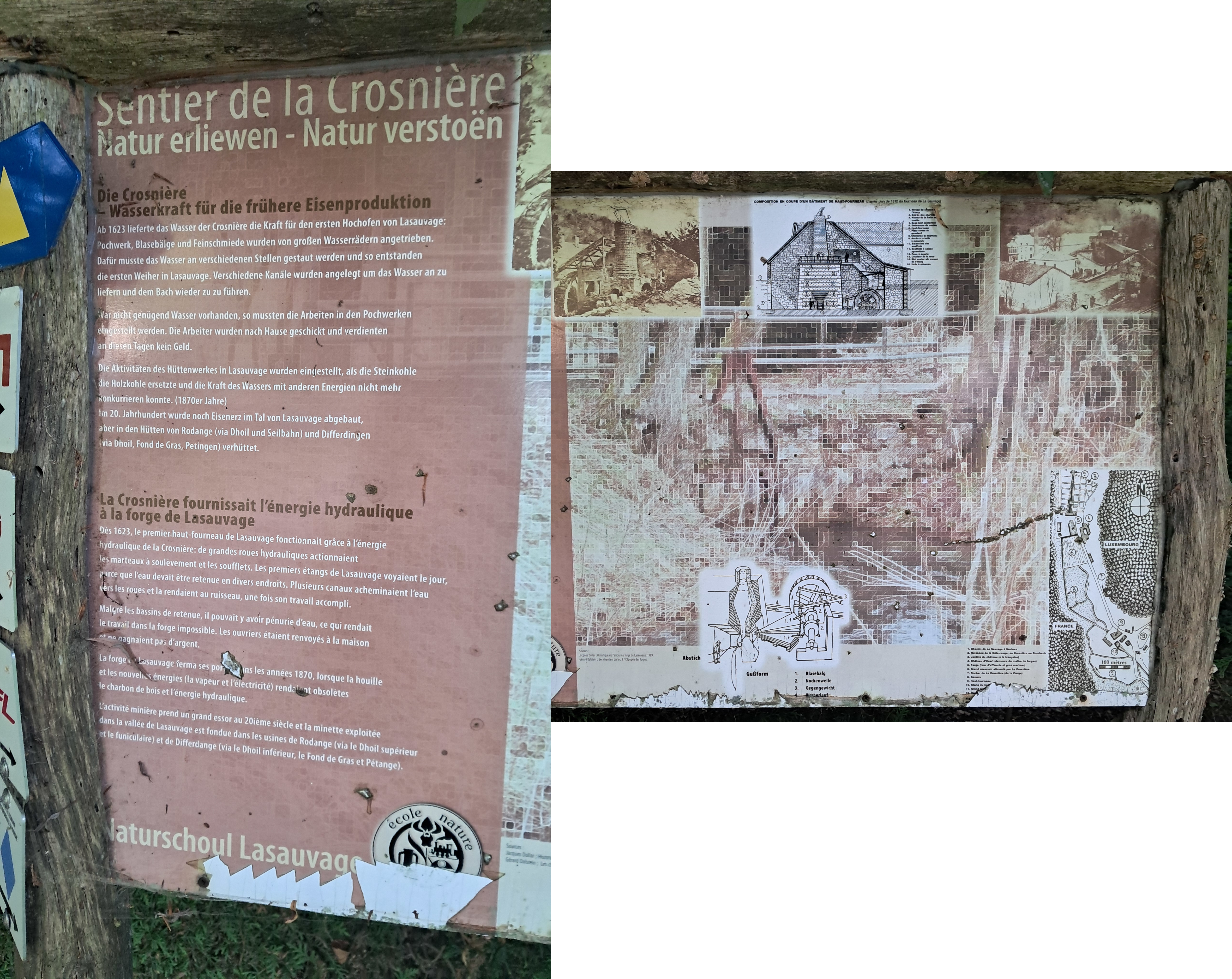
I reconstructed this view from two photographs, as I did not take a single photograph of the complete panel.
Read the transcribed text below:
Sentier de la crosnière
Natur erliewen - Natur verstoen
Die Corsnière - Wasserkraft für die frühere Eisenproduktion
Ab 1623 lieferte das Wasser der Crosnière die Kraft für den ersten Hochofen von Lasauvage: Pochwerk, Blasebälge und Feinschmiede wurden von großen Wasserrädern angetrieben. Dafür musste das Wasser an verschiedenen Stellen gestaut werden und so entstanden die ersten Weiher in Lasauvage. Verschiedene Kanäle wurden angelegt um das Wasser an zu liefern und dem Bach wieder zu zu führen.
War nicht genügend Wasser vorhanden, so mussten die Arbeiten in den Pochwerken eingestellt werden. Die Arbeiter wurden nach Hause geschickt und verdienten an diesen Tagen kein Geld.
Die Aktivitäten des Hüttenwerkes in Lasauvage wurden eingestellt, als die Steinkohle die Holzkohle ersetzte und die Kraft des Wassers mit anderen Energien nicht mehr konkurrieren konnte. (1870er Jahre) Im 20. Jahrhundert wurden noch Eisenerz im Tal von Lasauvage abgebaut aber in den Hütten von Rodange (via Dhoil und Seilbahn) und Differdingen (via Dhoil, Fond de Gras, Petingen) verhüttet.
La Crosnière fournissait l'énergie hydraulique à la forge de Lasauvage
Dès 1623, le premier haut-fourneau de Lasauvage fonctionnait grâce à l'énergie hydraulique de la Crosnière: de grandes roues hydrauliques actionnaient les marteaux à soulèvement et les soufflets. Les premiers étangs de Lasauvage voyaient le jour, parce que l'eau devait être retenue en divers endroits. Plusieurs canaux acheminaient l'eau vers les roues et le rendaient au ruisseau, une fois son travail accompli.
Malgré les bassins de retenue, il pouvait y avoir pénurie d'eau, ce qui rendait le travail dans la forge impossible. Les ouvriers étaient renvoyés à la maison et ne gagnaient pas d'argent.
La forge de Lasauvage ferma ses potes dans les années 1870, lorsque la houille et les nouvelles énergies (la vapeur et l'électricité) rendaient obsolètes le charbon de bois et l'énergie hydraulique.
L'activité minière prend un grand essor au 20ième siècle et la minette exploitée dans la vallée de Lasauvage est fondue dans les usines de Rodange (via le Dhoil supérieur et le funiculaire) et de Differdange (via le Dhoil inférieur, le Fond de Gras et Pétange).
Composition en coupe d'un bâtiment de haut-fourneau
(d'après plan de 1812 du fourneau de La Sauvage)
- Niveau du chemin de l'étang
- Entrée des chariots
- Niveau de la halle de coulée
- Sous-[texte illisible] souterrain
- Embrasure de coulée
- Haut-fourneau
- Plate-forme de [texte illisible]
- Cheminée du fourneau
- Accès à la halle à minerais
- Balanciers des soufflets
- Soufflets à caisse pyramidale
- Roue à [text illisible]
- Couriser de la roue
- [texte illisible] souterrain venant de l'étang
- Halle à minerais
Abstich
Gußform
- Blasebal
- Nockenwelle
- Gegengewicht
- Wasserlauf
- Chemin de La Sauvage à Saulners
- Ruisseau de la Côte-rouge, our Crosnière ou Roerbach
- Jardins du château (à la française)
- Château d'Huart (demeure du maître de forges)
- Forge (feux d'affinerie si gros marteau)
- Grand réservoir alimenté par La Crosnière
- Rocher de La Cronnière (de la Vierge)
- Canaux
- Heaut-fourneau
- Etang du h[texte illisible - panneau endommagé]
- Grand [texte illisible - panneau endommagé]
- [texte illisible - panneau endommagé]
The heron, the bat, the stag, the boar and some ducks and geese
There is also a map of the trail beside the information board. The trail actually has different paths that can be followed, each marked with a different type of animal. I chose to follow a mixture of them, starting with the heron-marked one (orange on the map) and then following the bat-marked one (black on the map). From there, I followed the stag-marked trail (green on the map) until point F, then the boar-marked trail (yellow on the map) until point G, and then again the stag-marked trail.
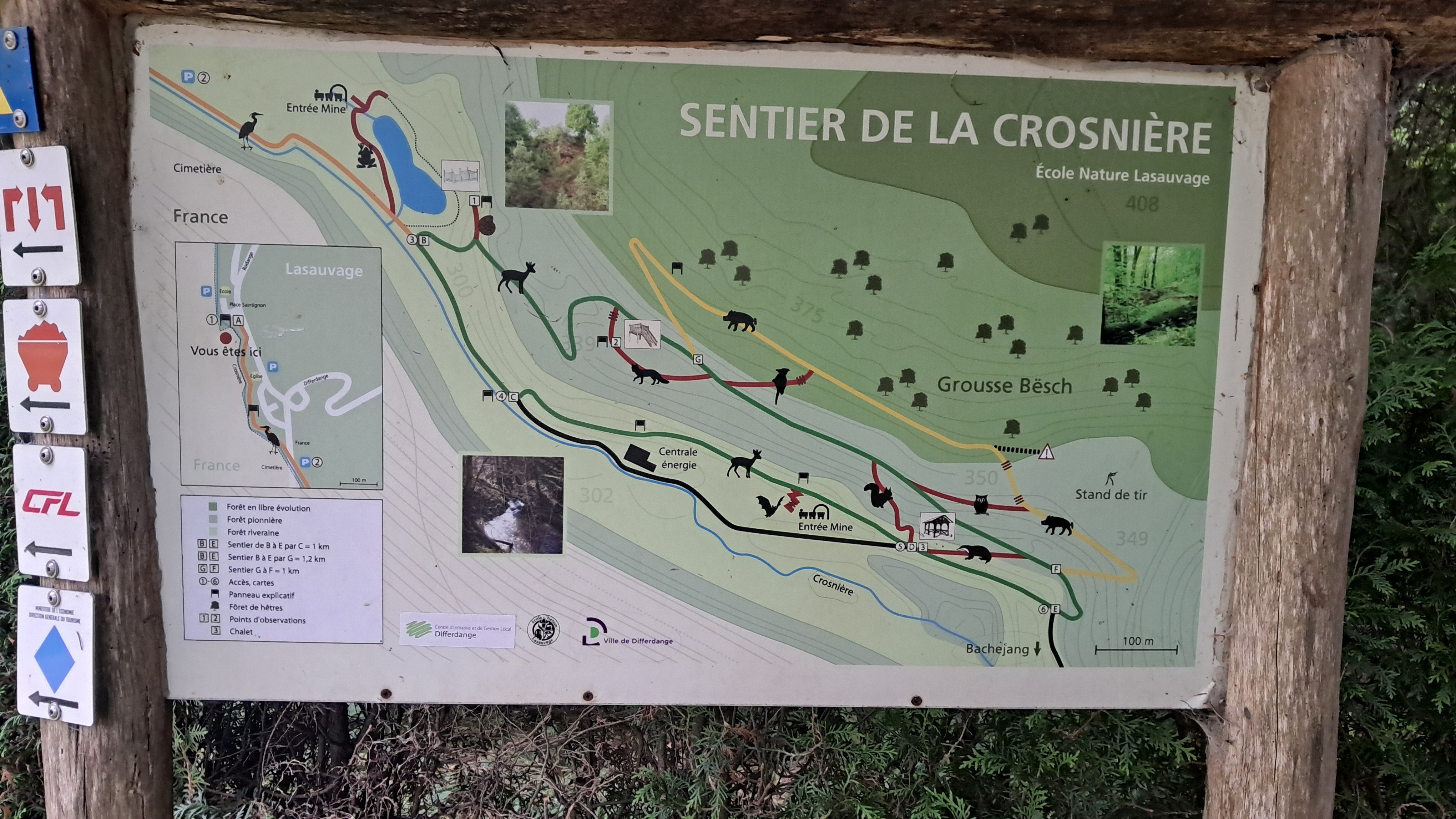
The orientation map at Lasauvage was a useful reference point before heading onto the trail.
From there, the trail leads through the park and over the border into France. It continues onto a wooden pier which is built around the pond known as "Kiercheweier", meaning "church pond" in Luxembourgish. This is explained by its location near the church named "Église Saint-Barbe". The church itself was desacralised in 2018 but is now used as an event venue by the Aalt Stadhaus, Differdange's cultural centre, where my previous trail started.
There is also an information board which is not actually an official part of the trail, but I took a photo anyway. It discusses the flora of the pond, the plants you will find here, and their importance to the surrounding fauna.
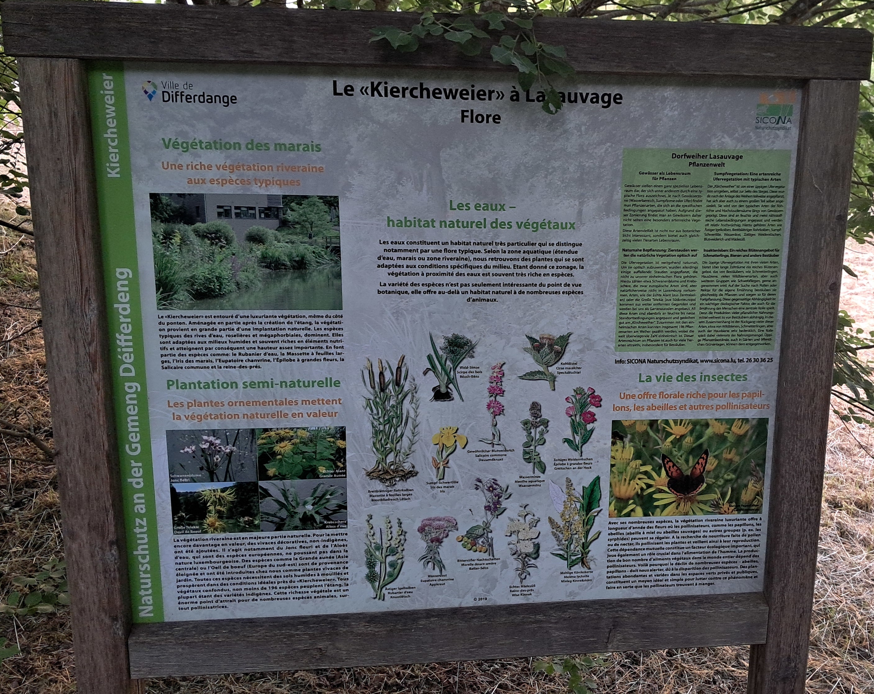
This interpretive panel stands beside the "Kiercheweier" in Lasauvage.
Read the transcribed text below:
Le «Kiercheweier» à Lasauvage
Flore
Les eaux - habitat naturel des végétaux
Les eaux constituent un habitat naturel très particulier qui se distingue notamment par une flore typique. Selon la zone aquatique (étendue d'eau, marais ou zone riveraine), nous retrouvons des plantes qui se sont adaptées aux conditions spécifiques du milieu. Étant donné ce zonage, la végétation à proximité des eaux est souvent très riches en espèces.
La variété des espèces n'est pas seulement intéressante du point de vue botanique, elle offre au-delà un habitat naturel à de nombreuses espèces d'animaux.
Végétation des marais
Une riche végétation riveraine aux expèces typiques
Le «Kiercheweier» est entouré d'une luxuriante végétation, même du côté du ponton. Aménagée en partie après la création de l'étang, la végétation provient en grande partie d'une implantation naturelle. Les espèces typiques des rives d'eau, roselières et mégaphorbiaies, dominent. Elles sont adaptées aux milieux humides et souvent riches en éléments nutritifs et atteignent par conséquent une hauteur assez importante. En font partie des expèces comme: le Rubanier d'eau, la Massette à feuilles larges, l'Iris des marais, l'Eupatoire chanvrine, l'Épilobe à grandes fleurs, la Salicaire commune et la reine-des-prés.
Plantation semi-naturelle
Les plantes ornementales mettent la végétation naturelle en valeur
La végétation riveraine est en majeure partie naturelle. Pour la mettre encore davantage en valeur, des vivaces décoratives, non-indigènes, ont été ajoutées. Il s'agit notamment du Jonc fleuri et de l'Aloès d'eau, qui sont des espèces européennes, ne poussant pas dans la nature luxembourgeoise. Des espèces comme la Grande aunée (Asie centrale) ou l'Oeil de boeuf (Europe du sud-est) sond de provenance éloignée et ont été introduites chez nous commes plantes vivaces de jardin. Toutes ces espèces nécessitent des sols humides à mouillés et prospèrent dans des conditions idéales près du «Kiercheweier». Tous végétaux confondus, non moins de 196 espèces peuplent l'étang. la plupart étant des variétés indigènes. Cette richesse végétale est un énomre point d'attrait pour de nombreuses espèces animales, sur-tout pollinisatrices.
La vie des insectes
Une offre florale riche pour les papillons, les abeilles et autre pollinisateurs
Avec ses nombreuses espèces, la végétation riveraine luxuriante offre à longueur d'année des fleur où les pollinisateurs, comme les papillons, les abeilles (abeille à miel ou abeilles sauvages) ou autres groupes (p. ex. les syrphides) peuvent se régaler. A la recherche de nourriture faite de pollen ou de nectar, ils pollinisent les plantes et veillent ainsi à leur reproduction. Cette dépendance mutuelle constitue un facteur écologique important, qui joue également un rôle crucial dans l'alimentation de l'homme. La production de bon nombre d'aliments végétaux dans le monde entier dépend des pollinisateurs. Voilà pourquoi le déclin de nombreuses espèces - abeilles, papillons - doit nous alerter, dû à la disparition des pollinisateurs. Des plantations abondantes et variées dans les espaces verts privés et publiques, constituent un moyen idéal et simple pour lutter contre ce phénomène et faire en sorte que les pollinateurs trouvent à manger.
Dorfweiher Lasauvage
Pflanzenwelt
Gewässer als Lebensraum für Pflanzen
Gewässer stellen einen ganz speziellen Lebensraum dar, der sich unter anderem durch eine typische Flora auszeichnet. Je nach Gewässerzone (Wasserbereich, Sumpfzone oder Ufer) findet man Pflanzenarten, die sich an die spezifischen Bedingungen angepasst ahben. Aufgrund dieser Zonierung findet man an Gewässern daher nicht selten eine besonders artenreiche Vegetation.
Diese Artenvielfat ist nicht nur aus botanischer Sicht interessant, sondern bietet auch gleichzeitig vielen Tierarten Lebensraum.
Sumpfvegetation:
Eine artenreiche Ufervegetation mit typischen Arten
Der "Kiercheweiher" ist von einer üppigen Ufervegetation umgeben, selbst zur Seite des Steges. Diese wurde nach der Anlage des Weihers teilweise angepflanzt, hat sich aber auch zu einem großen Teil selber angesiedelt. Sie wird von den typischen Arten der Röhrichte und Hochstaudensäume längs von Gewässern geprägt. Diese sind an feuchte und meist nährstoffreiche Lebensbedingungen angepasst und werden oft relativ hochwüchsig. Hierzu gehören Arten wie Ästiger Igelkolben, Breitblättriger Rohrkolben, Sumpf-Schwertlilie, Wasserdost, Zottiges Weidenröschen, Blutweiderich und Mädesüß.
Naturnahe Bepflanzung
Zierstauden werten die natürliche Vegetation optisch auf
Die Ufervegetation ist weitgehend naturnah. Um sie optisch aufzuwerten, wurden allerdings einige auffallende Stauden angepflanzt, die nicht zu unserer einheimischen Flora gehören. Hierzu zählen etwa Schwanenblume und Krebsschere, die zwar europäische Arten sind, aber natürlicherweise nicht in Luxemburg vorkommen. Arten, wie der Echte Alant (aus Zentralasien) oder die Große Telekie (aus Südosteuropa) kommen aus weiter entfernten Gegenden und werden bei uns als Gartenstauden angebaut. All diese Arten sind ebenfalls an feuchte bis nasse Standortbedingungen angepasst und gedeihen gut am "Kiercheweiher". Zusammen mit den einheimischen Arten konnten insgesamt 196 Pflanzenarten am Weiher gezählt werden, wobei die weit überwiegende Zahl einheimisch ist. Dieser Artenreichtum an Pflanzen ist auch für viele Tierarten attraktiv, insbesondere für Bestäuber.
Insektenleben
Ein reiches Blütenangebot für Schmetterlinge, Bienen und andere Bestäuber
Die üppige Ufervegetation mit ihren vielen Arten, bietet über lange Zeiträume ein reiches Blütenangebot, das von Bestäubern, wie Schmetterlingen, Hausbiene, vielen Wildbienenarten, aber auch weiteren Gruppen wie Schwebfliegen, gerne angenommen wird. Auf der Suche nach Pollen oder Nektar für die eigene Ernährung bestäuben sie gleichzeitig die Pflanzen und sorgen so für deren Fortpflanzung. Diese gegenseite Abhängigkeit ist ein wichtiger ökologischer Faktor, der auch für alle Ernährung des Menschen eine zentrale Rolle spielt. Denn die Produktion vieler pflanzlicher Nahrungsmittel weltweit ist von Bestäubern abhängig. In diesem Zusammenhang ist der Rückgang vieler dieser Arten, etwa von Wildbienen, Schmetterlingen, aber auch der Hausbiene sehr bedenklich. Eine Rolle spielt dabei vielerorts der Nahrungsmangel. Üppige Pflanzenbestände auch in Gärten und öffentlichen Grünanlage, können dem entgegenwirken.
Wald-Simse
Scirpe des bois
Bësch-DënsKohldistel
Cirse maraicher
SpeckdëschtelBreitblättriger Rohrkolben
Massette à feuilles larges
Breetbliedresch LëtschSumpf-Schwertlilie
Iris des marais
IrisGewöhnlicher Blutweiderich
Salicaire commune
DausendknuetWasserminze
Menthe aquatique
WassermënzZottiges Weidenröschen
Épilobe à grandes fleurs
Gréitschen an der HeckÄstiger Igelkolben
Rubanier d'eau
KnuetlëtschWasserdost
Eupatoire chanvrine
AppkrautBittersüßer Nachtschatten
Morelle douce-amère
Batter-SéissEchtes Mädesüß
Reine-des-prés
Wise-KinnekMehlige Könikskerze
Molème lychnite
Mieleg Kinnekskërz
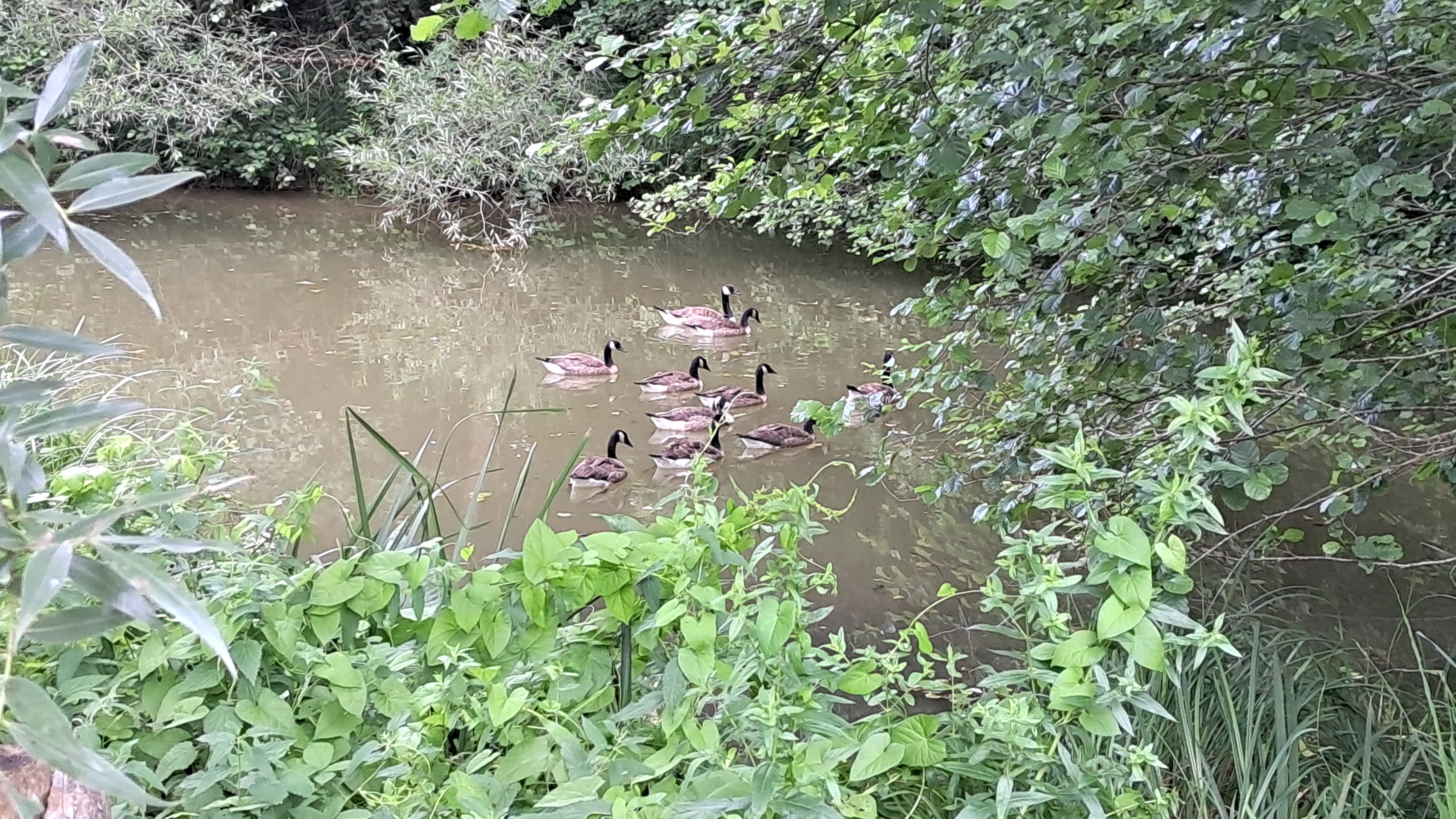
As I walked along the pier, I noticed some ducks and geese, which I, of course, photographed. We will encounter the geese again later.
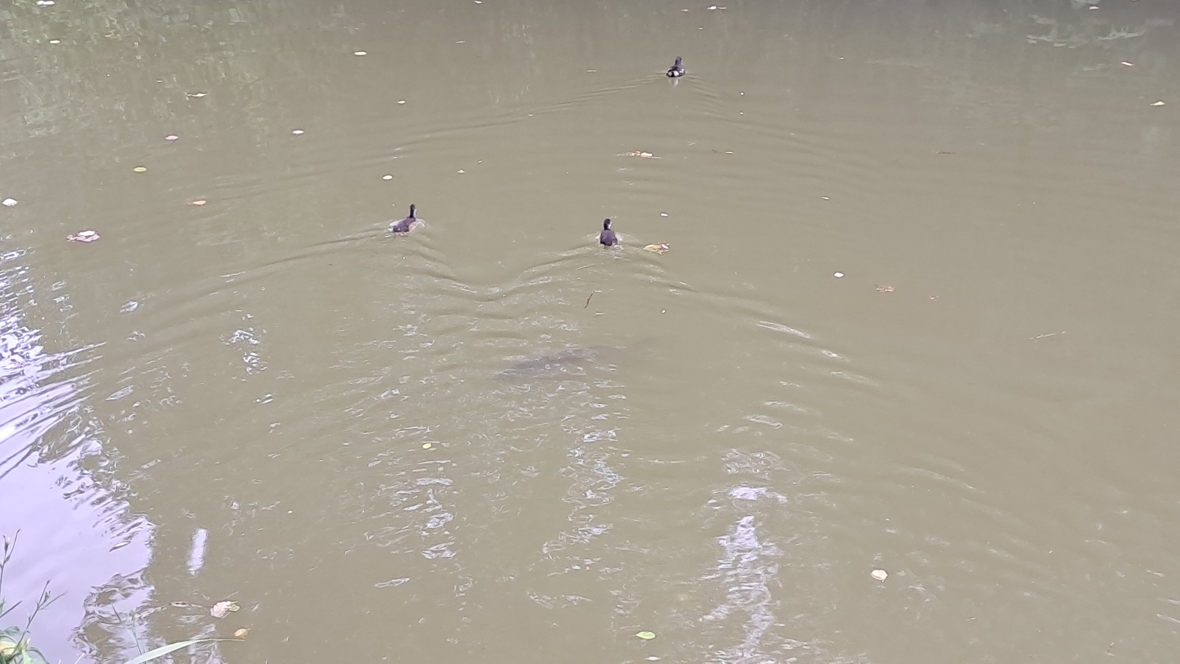
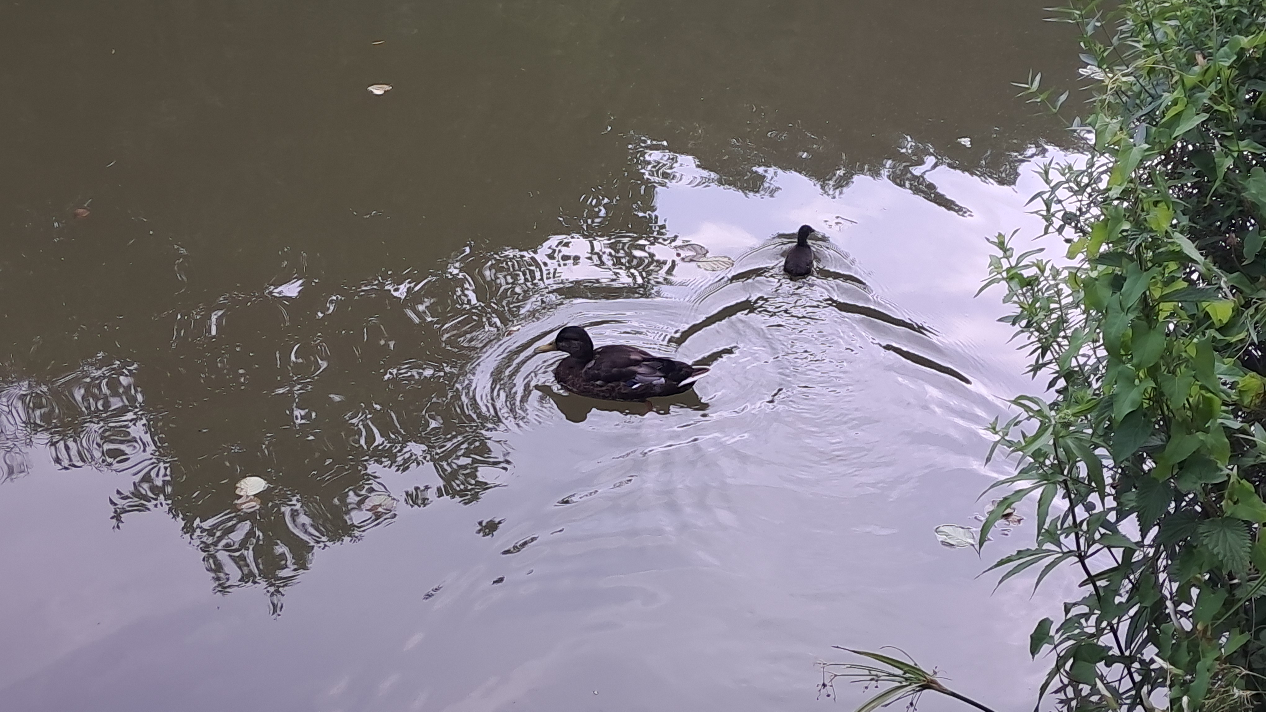
A few steps later, I came to a second information board, which is part of the trail, discussing the stream and its fauna. The stream's source is 400 metres west of a place called "Baache Jang"; from there, it flows into the Chiers — you may remember this from my previous hiking log. Apparently, before 2005, Lasauvage's wastewater entered the Crosnière unfiltered.
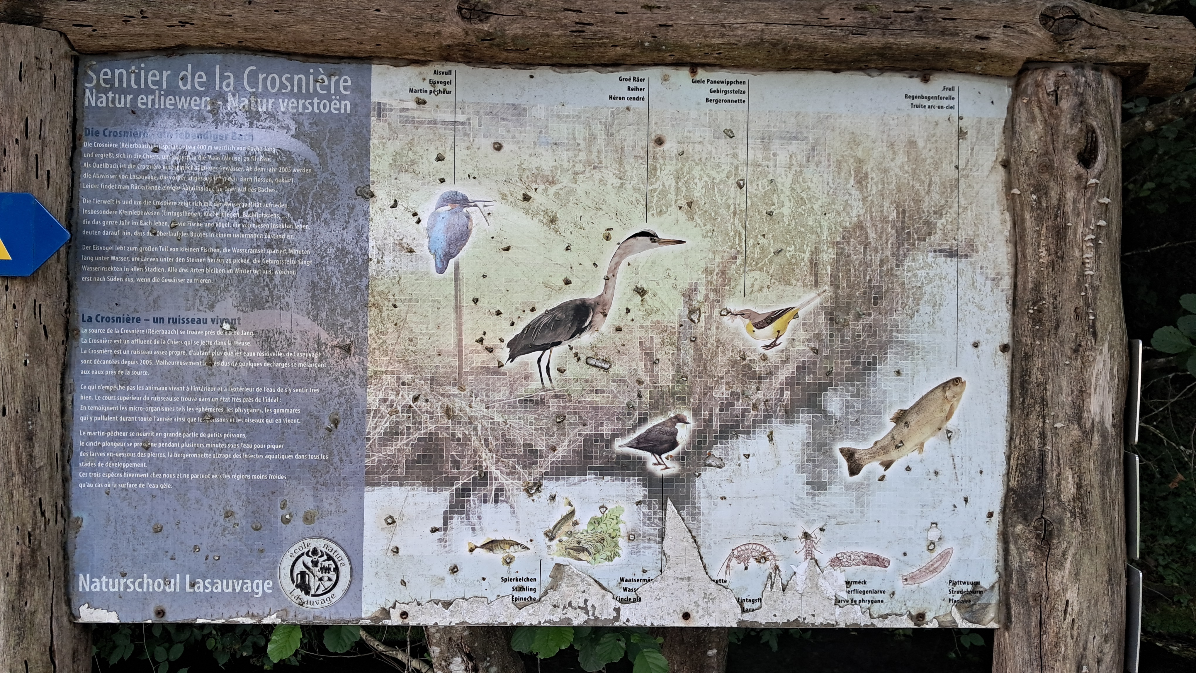
One of the information panels encountered along the Sentier de la Crosnière.
Read the transcribed text below:
Sentier de la crosnière
Natur erliewen - Natur verstoen
Die Crosnière - ein lebendiger Bach
Die Crosinère (Réierbaach) entspringt etwa 400 m westlich von Baache Jang und ergießt sich in die Chiers, um danach in die Maas (Meuse) zu fließen. Als Quellbach ist die Crosnière ein ziemlich sauberes Gewässer. Ab dem Jahr 2005 werden die Abwässer von Lasauvage, die vorher ungesäubert in den Bach flossen, geklärt. Leider findet man Rückstande einiger Abfallhalden im Oberlauf des Baches.
Die Tierwelt in und um die Crosnière zeigt sich mit der Wasserqualität zufrieden. Insbesondere Kleinlebewesen (Eintagsfliegen, Röcherfliegen, Bachflohkrebs, ...) die das ganze Jahr im Bach leben, sowie Fische und Vögel, die von diesen Insekten leben, deuten darauf hin, dass der Oberlauf des Baches in einem naturnahen Zustand ist.
Der Eisvogel lebt zum großen Teil von kleinen Fischen, die Wasseramsel spaziert Minuten lang unter Wasser, um Larven unter den Steinen heraus zu picken, die Gebirgsstelze fängt Wasserinsekten in allen Stadien. Alle drei Arten bleiben im Winter bei uns, weichen erst nach Süden aus, wenn die Gewässer zu frieren.
La Crosnière - un ruisseau vivant
La source de la Crosnière (Réierbaach) se trouve près de Baache Jang. La Crosnière est un affluent de la Chiers qui se jette dans la Meuse. La Crosnière est un ruisseau assez propre, d'autant plus que les eaux résiduelles de Lasauvage sont décantées depuis 2005. Malheureusement les résidus de quelques décharges se mélangent aux eaux près de la source.
Ce qui n'empêche pas les animaux vivant à l'intérieur et à l'extérieur de l'eau de s'y sentir très bien. Le cours supérieur du ruisseau se trouve dans un état très près de l'idéal: En témoignent les micro-organismes tels les éphémères, les phryganes, les gammares qui y pullulent durant toute l'année ainsi que les poissons et les oiseaux qui en vivent.
Le martin-pêcheur se nourrit en grande partie des petits poissons, le cincle plongeur se promène pendant plusieurs minutes sous l'eau pour piquer des larves en-dessous des pierres, la bergeronnette attrape des insectes aquatiques dans tous les stades de développement. Ces trois espèces hivernent chez nous et ne partent vers les régions moins froides qu'au cas où la surface de l'eau gèle.
Aisvull
Eisvogel
Martin pêcheurGroë Räer
Reiher
Héron cendréGiele Panewippchen
Gebirgsstelze
BergeronnetteFrell
Regenbogenforelle
Truite arc-en-cielSpierkelchen
Stachline
EpinocheWaasermä[Text onliesbar - Tafel beschiedegt]
Wass[Text unleserlich - Tafel beschädigt]
Cincle pi[texte illisible - panneau endommagé][Text onliesbar - Tafel beschiedegt]
Eintasgsf[Text unleserlich - Tafel beschädigt]
Larve[texte illisible - panneau endommagé][Text onliesbar - Tafel beschiedegt]erméck
[Text unleserlich - Tafel beschädigt]erfliegenlarve
[texte illisible - panneau endommagé]arve de phryganePlattwuurm
Strudelwurm
Planaire
Entering the forest
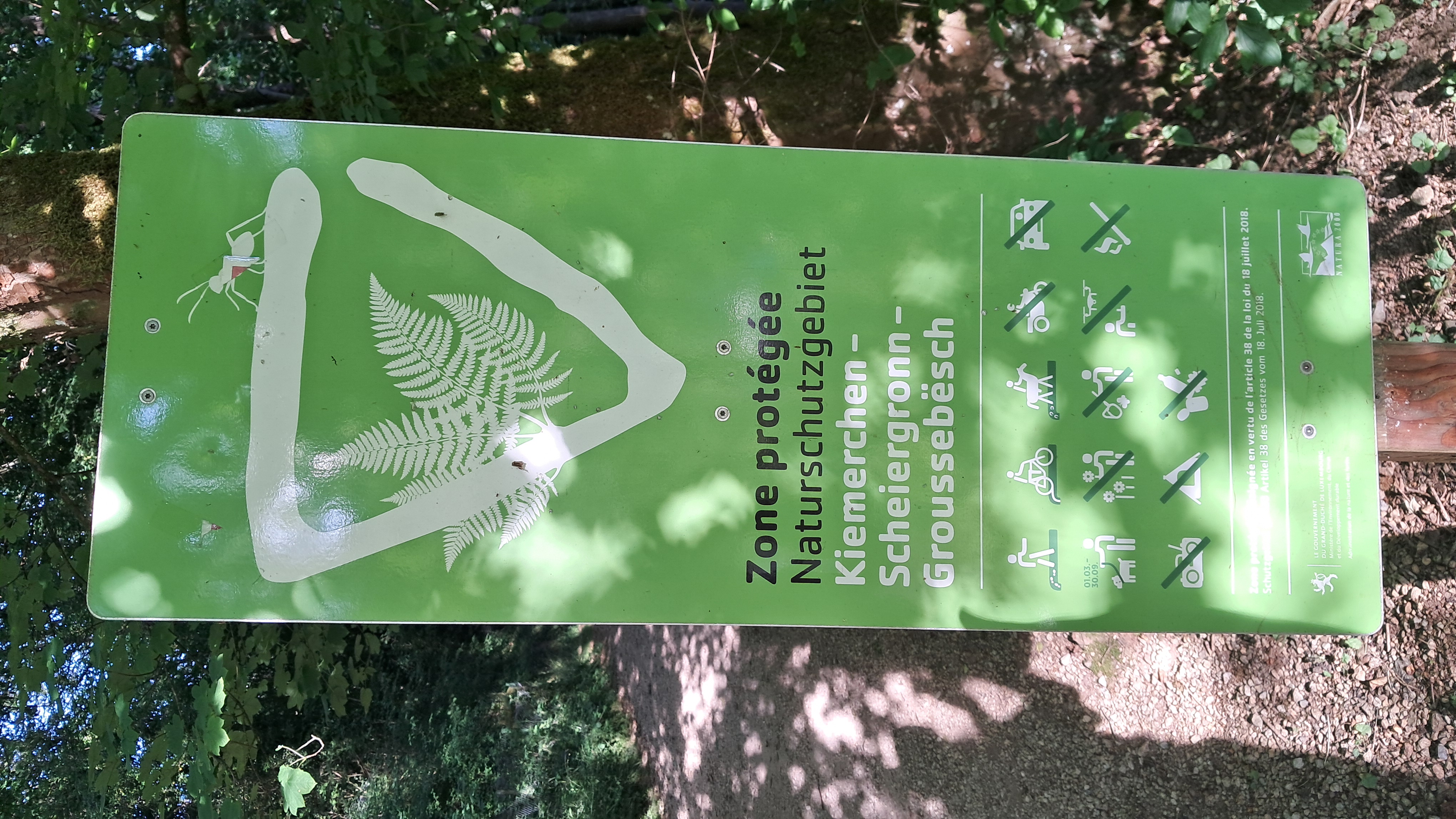
Here the trail enters the Kiemerchen – Scheiergronn – Groussebësch protected area.
The trail follows the stream until it reaches the entrance to the forest, which is marked by a sign indicating that it is a designated nature reserve named "Kiemerchen - Scheiergronn - Groussebësch". As soon as I entered the forest, I loved the cooling sensation on my skin and the refreshing air.
The path then leads past an information board about floodplain forests. As the Crosnière is very narrow, only a small part of the surrounding forest is considered a floodplain forest. The board also discusses the types of trees that can be seen here and describes how the basket willow has been shaped by human cultivation.
The trail then leads past a ruin. From the outside, it is impossible to tell what the building was originally used for, but according to OpenStreetMap, it used to be a power station. Not far away, I also saw the entrance to the old Lasauvage mine.
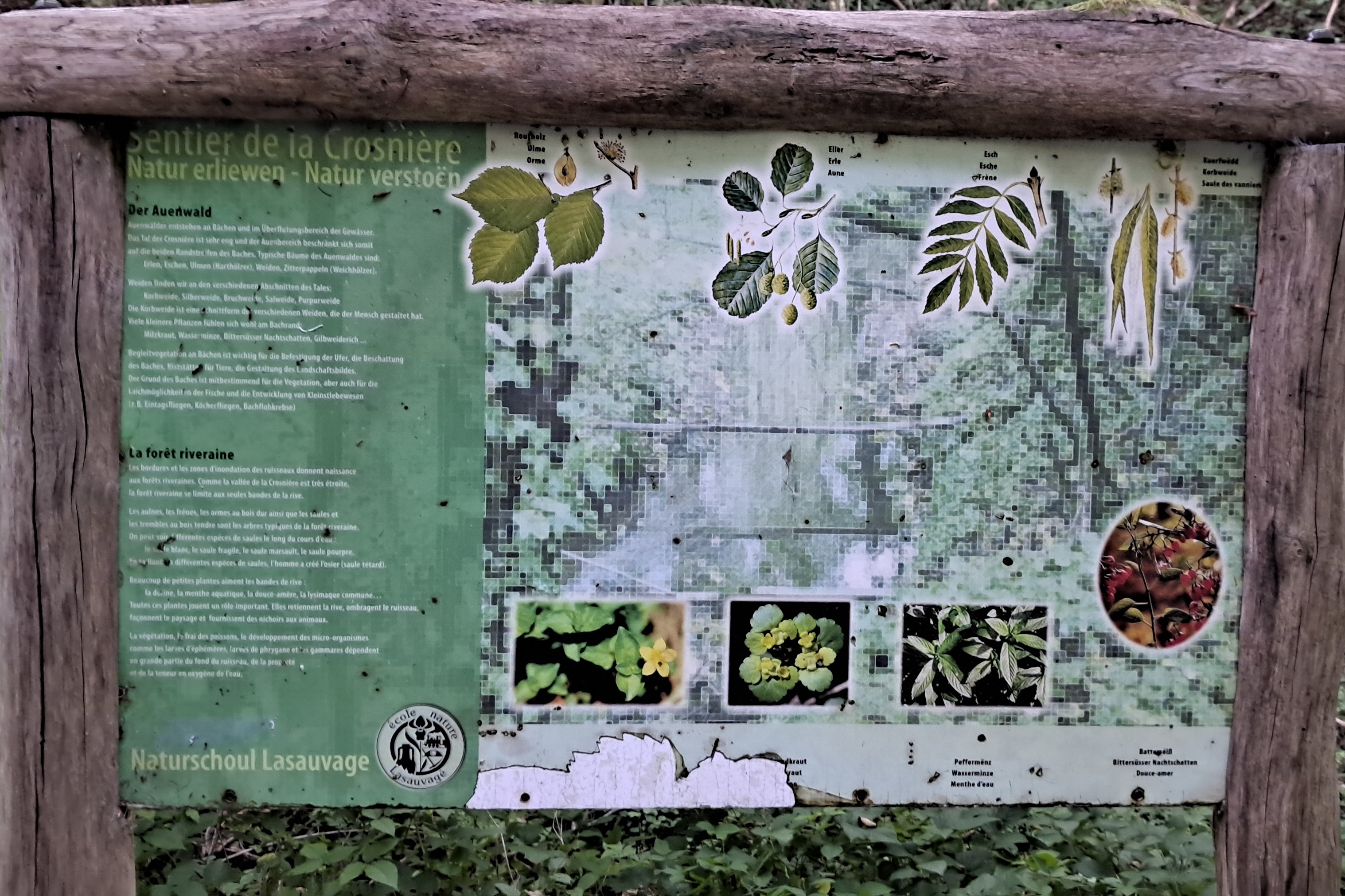
Another of the interpretive panels encountered along the Sentier de la Crosnière.
Read the transcribed text below:
Sentier de la crosnière
Natur erliewen - Natur verstoen
Der Auenwald
Auenwälder entstehen an Bächen und im Überflutungsbereich der Gewässer. Das Tal der Crosnière ist sehr eng und der Auenbereich beschränkt sich somit auf die beiden Randstreifen des Baches. Typische Bäume des Auenwaldes sind: Erlen, Eschen, Ulmen (Harthhölzer), Weiden, Zitterpappeln (Weichhölzer).
Weiden finden wir an den verschiedenen Abschnitten des Tales: Korbweide, Silberweide, Bruchweide, Salweide, Purpurweide
Die Korbweide ist eine Schnittform der verschiedenen Weiden, die der Mensch gestaltet hat. Viele kleinere Pflanzen fühlen sich woch am Bachrand: Milzkraut, Wasserminze, Bittersüsser Nachtschatten, Gilbweiderich ...Begleitvegetation an Bächen ist wichtig für die Befestigung der Ufer, die Beschattung des Bachess, Niststätte für Tiere, die Gestaltung des Landschaftsbildes. Der Grund des Baches ist mitbestimmend für die Vegetation, aber auch für die Laichmöglichkeiten der Fische und die Entwicklung von Kleinstlebewesen (z.B. Eintagsfliegen, Köcherfliegen, Bachflohkrebse)
La forêt riveraine
Les bordures et les zones d'inondation des ruisseaux donnent naissance aux forêts riveraines. Comme la vallée de la Crosnière est très étroite, la forêt riveraine se limite aux seules bandes de la rive.
Les aulnes, les frênes, les ormes au bois dur ainsi que les saules et les trembles au bois tendre sont les arbres typiques de la forêt riveraine. On peut voir différentes espèces de saules le long du cours d'eau: le saule blanc, le saule fragile, le saule marsault, le saule pourpre.
En croisant différentes espèces des saules, l'homme a créé l'osier (seule têtard).Beaucoup de petites plantes aiment les bandes de rive: le dorine, la menthe aquatique, la douce-amère, la lysimaque commune...
Toutes ces plantes jouent un rôle important. Elles retiennent la rive, ombragent le ruisseau, façonnent le paysage et fournissent des nichoirs aux animaux.La végétation, le frai des poissons, le développement des micro-organismes comme les larves d'éphémères, larves de phrygane et les gammares dépendent en grande partie du fond du ruisseau, de la propreté et de la teneur en oxygène de l'eau.
Roufholz
Ulme
OrmeEller
Erle
AuneEsch
Esche
FrèneKuerfwëdd
Korbweide
Saule des ranniers[Text onliesbar - Tafel beschiedegt]kraut
[Text unleserlich - Tafel beschädigt]raut
[texte illisible - panneau endommagé]Peffermënz
Wasserminze
Menthe d'eauBatterséiß
Bittersüsser Nachtschatten
Douce-amer
Taking a wrong turn and obstacles in the way
After passing the mine, the trail began to ascend, which I could also tell from my increasing heart rate. At the point marked F on the map, I remembered that the VisitLuxembourg website said to follow the stag sign. However, when I looked at my GPS, I realised that I had gone off the trail. Fortunately, I hadn't gone too far, so I backtracked to point F and then followed the trail as marked on my GPS.
Looking at it again, I notice that the official trail on the website is a mixture of the paths I described earlier rather than following a single animal marker.
Upon reaching the summit of the trail, I continued along it, which led to some obstacles. There was a fallen tree on the trail, so I stopped for a few seconds to analyse the situation and decide on the best way to tackle it without hurting myself. At this point, I wished I had already bought some hiking shoes, as this would have made the adventure a little less risky.
As luck would have it, a few dozen metres after the first fallen tree, I came to a second one, which was smaller and easier to get over. I have, of course, already informed the local forester, and I hope that the fallen trees have been cleared away and the trail made safe again.
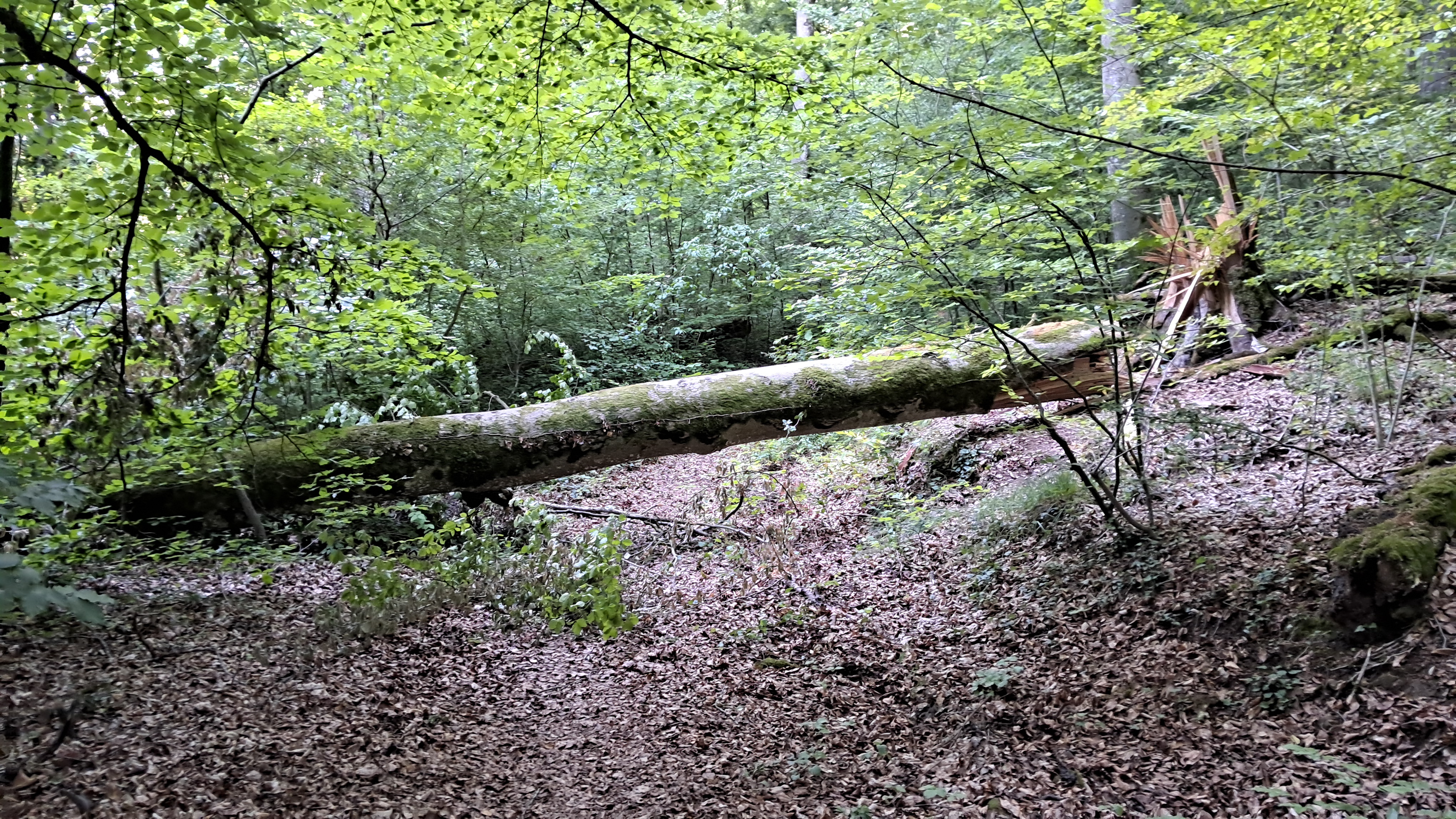
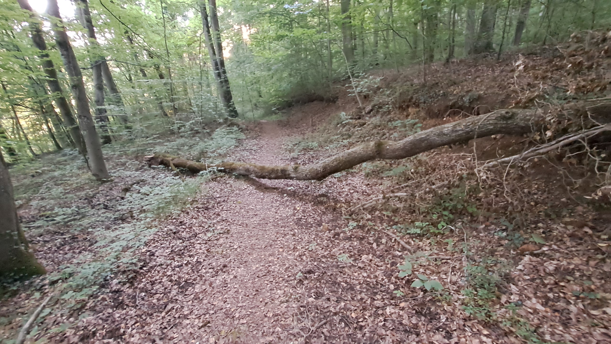
The return of the geese
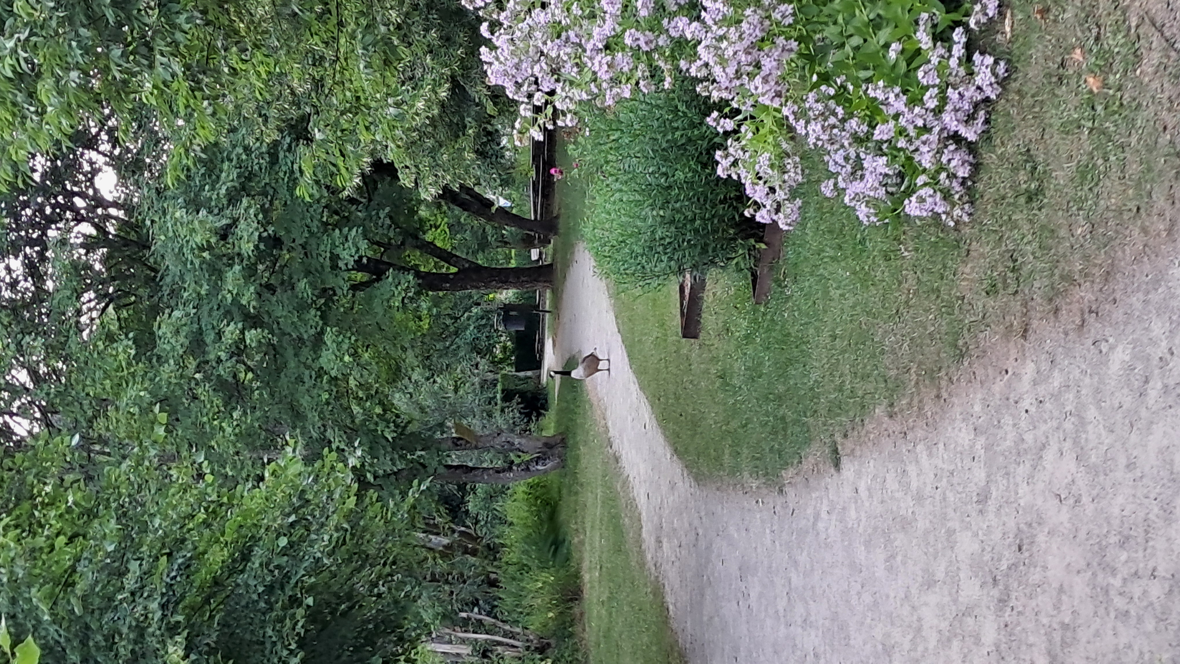
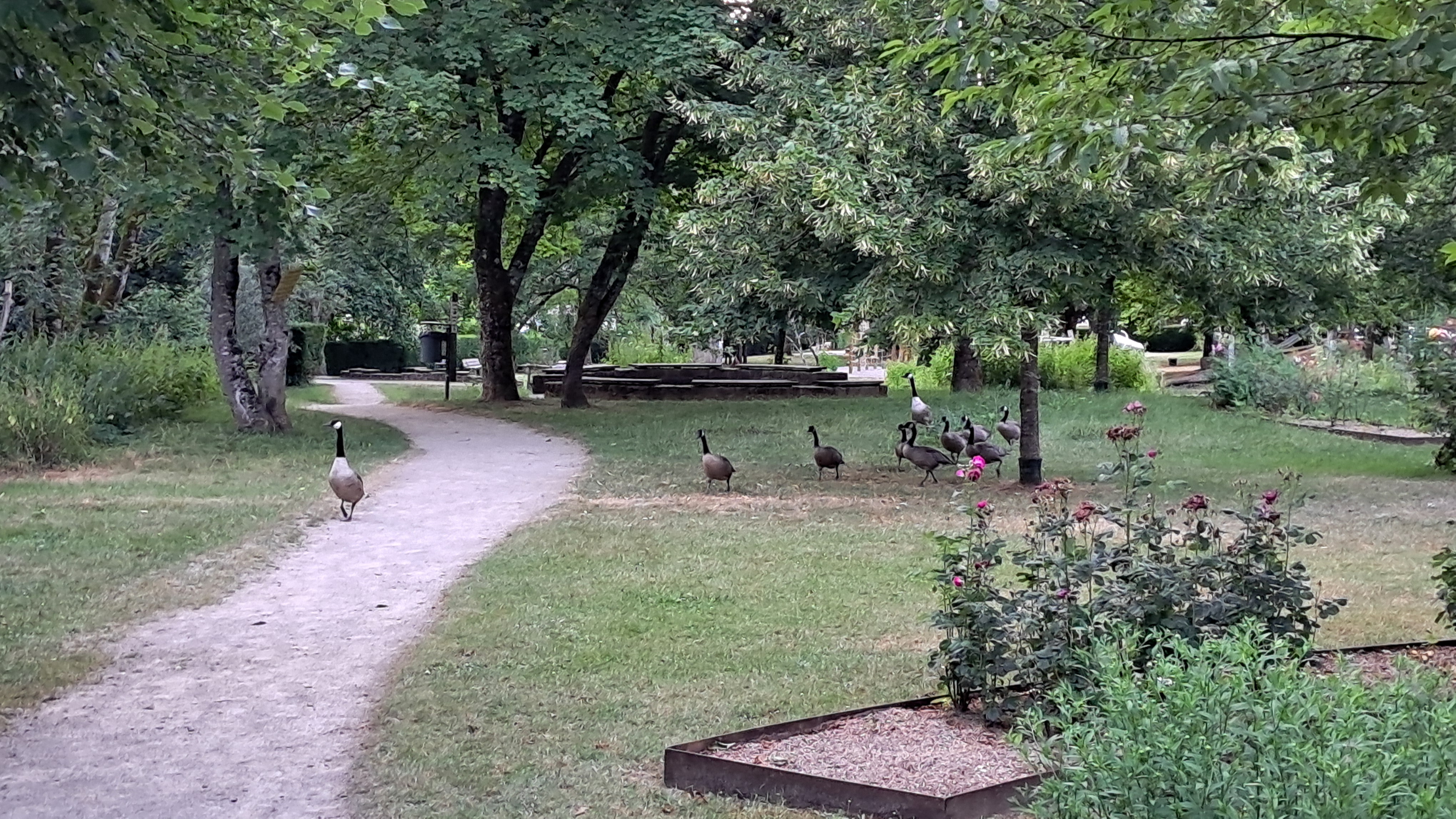
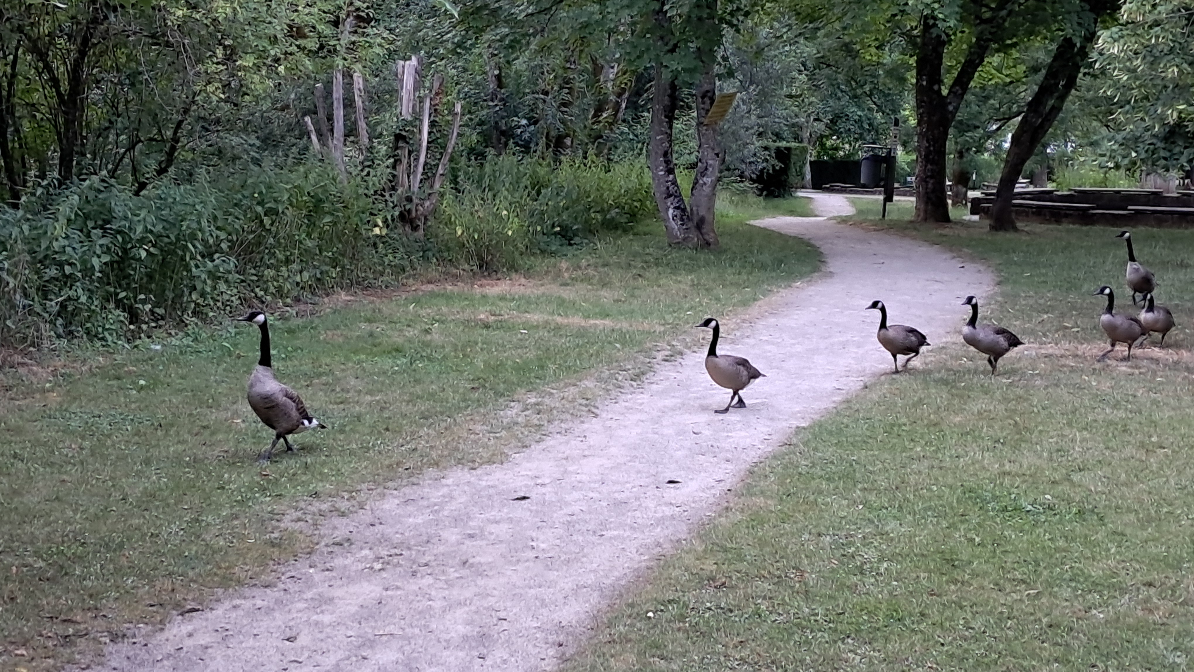
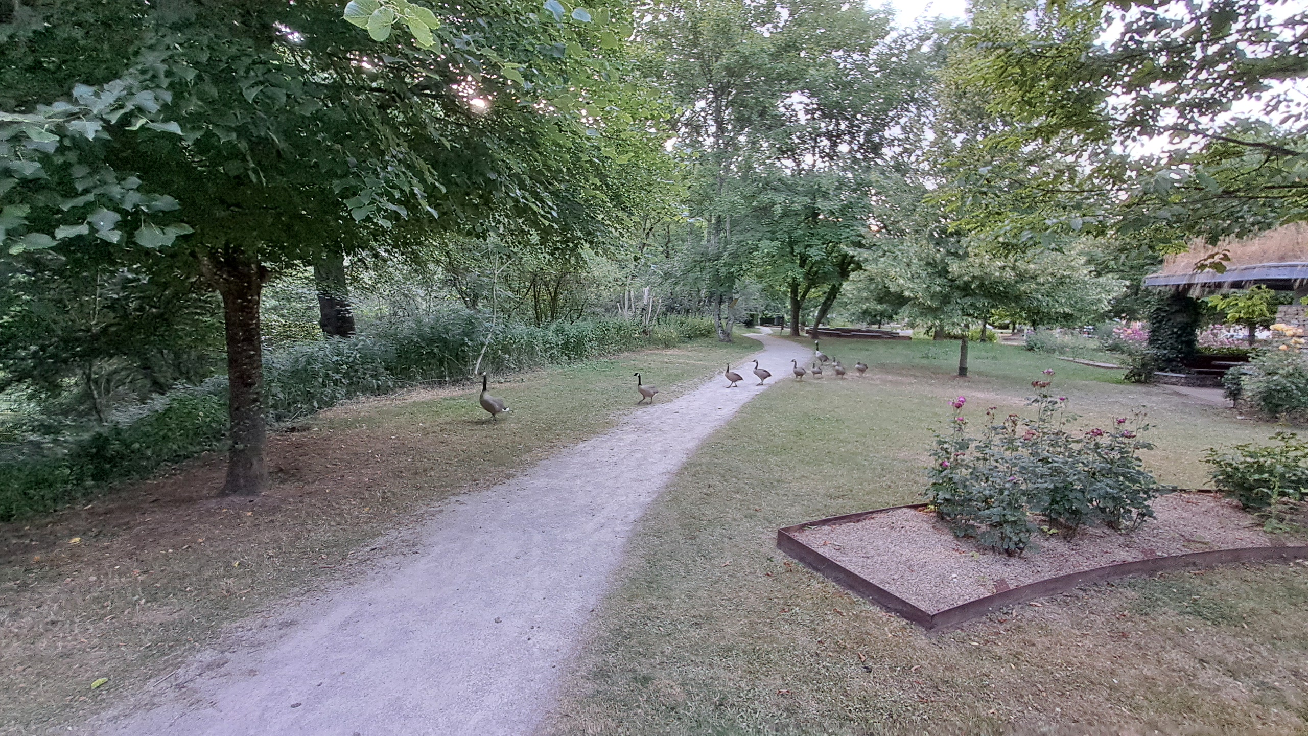
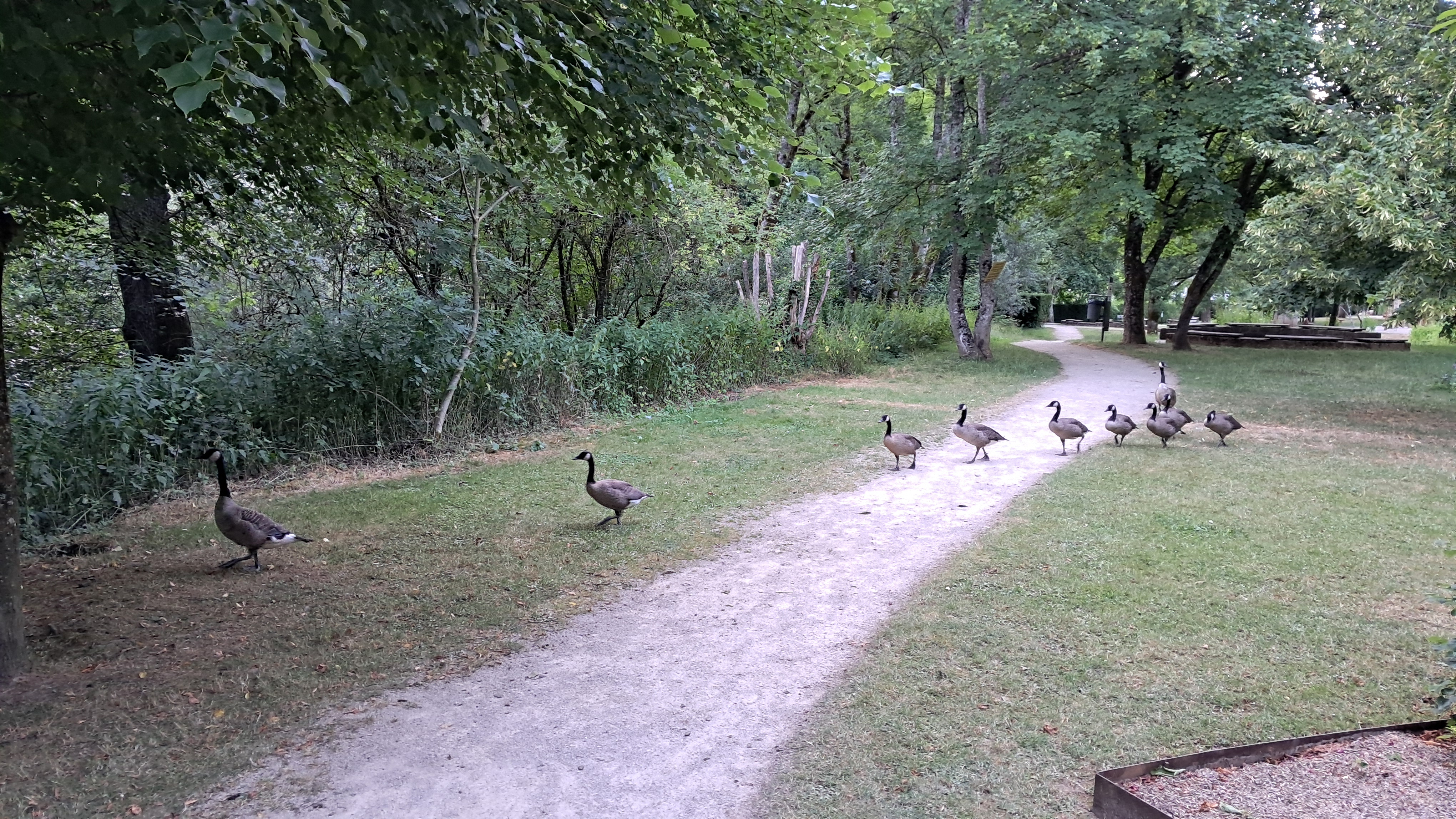
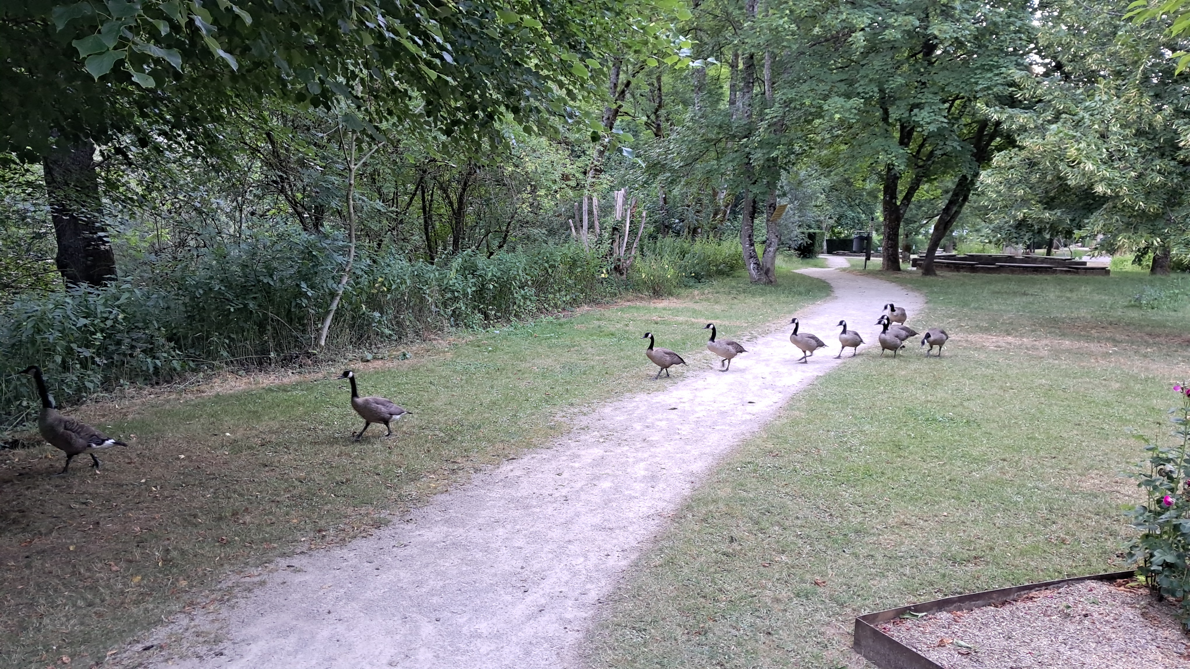
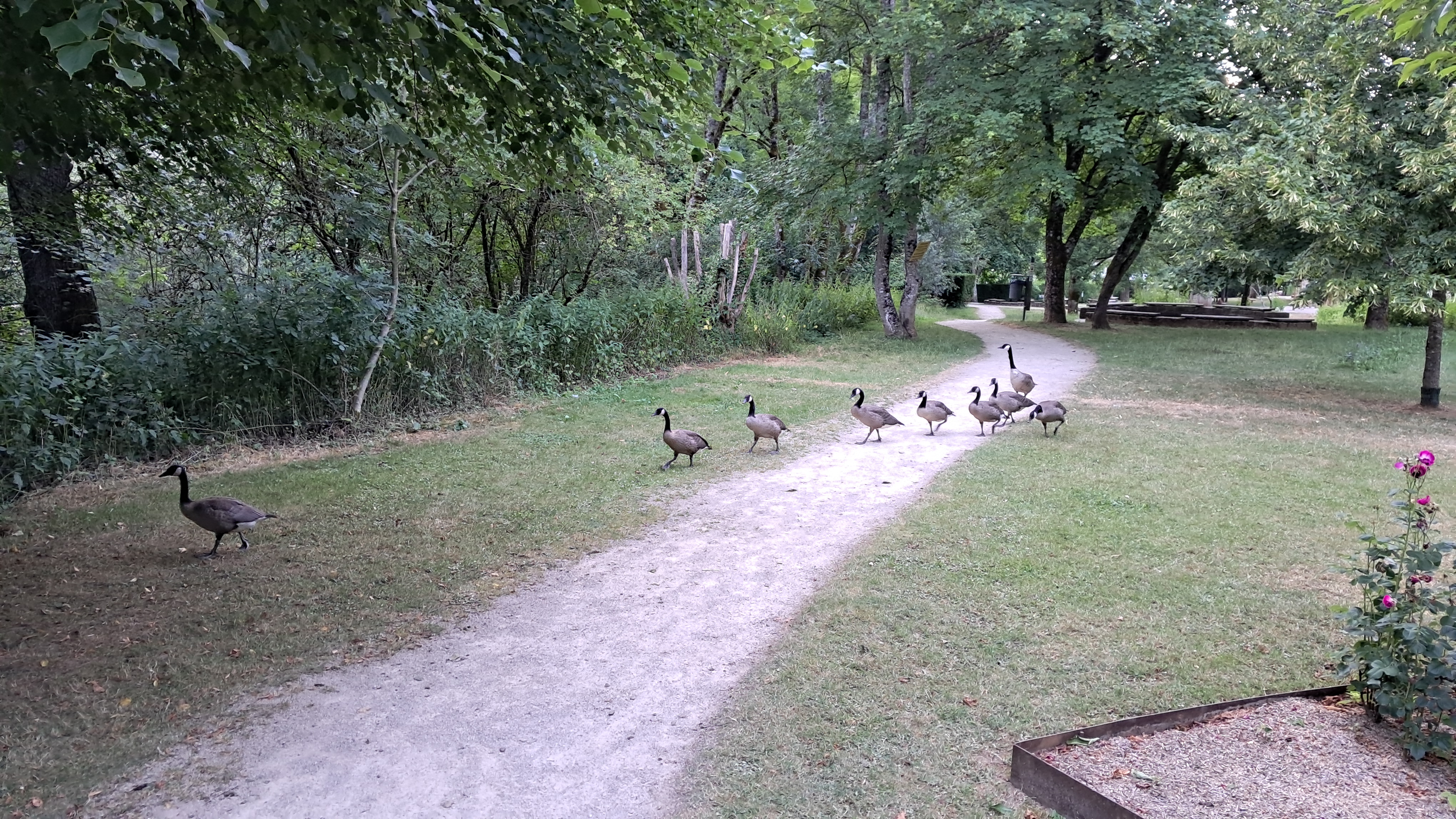
I then started the descent of the trail very carefully, despite not wearing hiking shoes. I passed a small pond again and continued along the same path out of the forest. When I arrived at the "Kiercheweier", my friends the geese had made their way into the park. They did not seem to be afraid of me, so I took some photos of them as they came quite close before heading back into the pond.
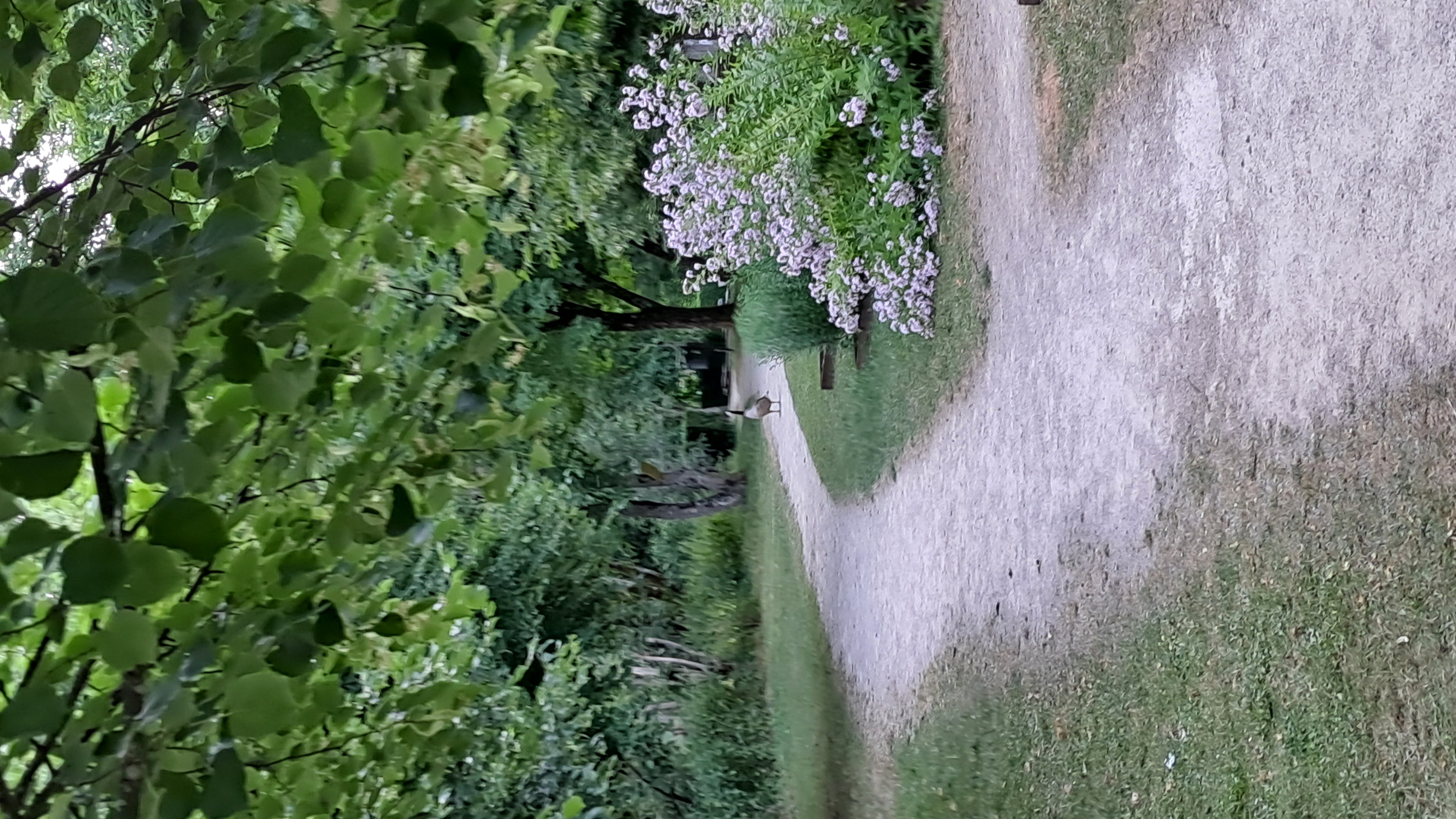
Looking back at the trail
I found this trail well suited to an evening walk, except for the unforeseen obstacles in the way. I especially liked the section around the "Kiercheweier".
Would I recommend coming to Lasauvage just to do this trail? No, but if you're in the Lasauvage area, for example visiting the Eugène Pesch Museum or near the Minett Park Fond-de-Gras, you could fit it in. Or, if you're staying in the Kabaisercher: La Sauvage and want to go for an evening walk, then yes, you should do it.
All in all, my Wanderlust was sated for the evening. But knowing Wanderlust, probably not for long.